
What will Bermuda look like in the face of rising seas and other climate risks? A new interactive tool, launched by Government, is providing a clearer picture of the island’s future.
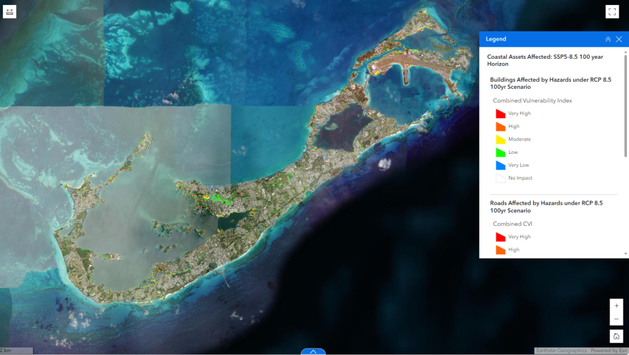
Small island and developing states are often described as being on the frontlines of climate change, but for territories without immediate, visible signs, the future impacts can be hard to imagine.
That’s why many stakeholders are leveraging tools such as Geographic Information Systems to visualise environmental data and inform climate adaptation and mitigation efforts.
Today, the government unveiled its own GIS platform based on the findings of the recently published Climate Change and Its Impact on Bermuda Study.
In colourful, interactive data layers, the platform maps out:
- Projected sea-level rise and its impact on Bermuda’s coastline and infrastructure
- Vulnerability assessments for communities, ecosystems, and key industries
- Climate adaptation measures and priority areas for intervention
Walter Roban, the Minister of Home Affairs, underscored the importance of the initiative, explaining: “Bermuda is at the forefront of addressing climate change in a meaningful way. This GIS platform not only complements the findings of our climate change study but also empowers residents, businesses, and policymakers with the tools they need to make informed decisions. Our goal is to ensure a sustainable future for generations to come.”
The GIS platform is now live and accessible to the public at gov.bm/climatechange.