
The Bermuda Weather Service is tracking Hurricane Erin which is currently 336 nm to the west-north-west of Bermuda as of 3pm today
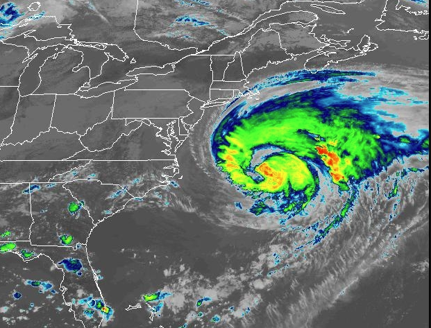
Hurricane Erin captured by NOAA near the East Coast of the United States. Photo: National Hurricane Centre
A tropical storm warning is in effect now as forecasters track Hurricane Erin.
The Bermuda Weather Service upgraded to tropical storm warning this afternoon at 3pm.
Erin, which caused severe coastal flooding in North Carolina and along the upper east coast of the U.S. today, is expected to be at its nearest point to the island at 6pm this evening, within 346 nautical miles to the west-north-west.
According to the National Hurricane Center, Erin is moving toward the northeast near 30 km/h (18 mph). A faster northeastward to east-northeastward motion is expected during the next couple of days.
“On the forecast track, the center of Erin will move over the western Atlantic between the U.S. east coast and Bermuda through early Friday, and then pass south of Atlantic Canada Friday and Saturday.”
Maximum sustained winds are recorded near 100 mph (155 km/h) with higher gusts, said the NOAA.
Locally, there were 11 customers reported without power in St. George’s at 3.23pm Thursday.
Businesses will remain open as normal and the Causeway will stay open during the passing of Hurricane Erin, according to the Acting National Security Minister Jache Adams.