
The Bermuda Weather Service expect to upgrade the forecast to a Tropical Storm warning later today or tonight
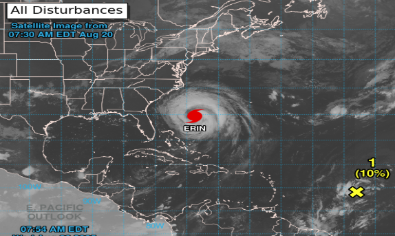
Hurricane Erin pictured in the Atlantic Ocean as of Wednesday morning. Photo: NOAA/Bermuda Weather Service
A tropical storm watch is currently in effect as forecasters track Hurricane Erin.
The Bermuda Weather Service forecasts that Erin will be at its closest – 320 nautical miles to the North West of the island – on Thursday at 10pm, though this forecast is subject to change.
The BWS could upgrade to Tropical Storm Warning later today or tonight.
The Cat 2 system is currently tracking 486 nautical miles to our West South West, packing maximum winds of 85 knots with gusts to 105 knots.
Starting tomorrow, we could see tropical storm force winds, with life-threatening storm surges at sea.
“Seas continue to build – possible peaking near 12ft tonight – while hazardous swells and rip currents continue to develop from the south ahead of Hurricane Erin,” according to the BWS.
Acting National Security Minister Jache Adams this week said business will remain as normal – but he urged residents to make storm preparations.
A full Storm-Season Energy Checklist – a practical reference guide that aims to help households navigate the storm with greater security and affordability – can be found online at bbc.bm.