
Storm is being monitored closely by forecasters
Source: https://weather.bm/
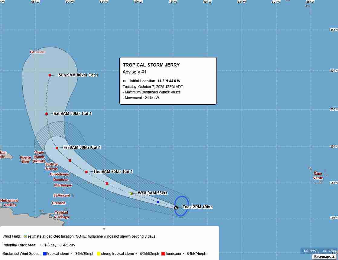
Conditions are expected to be favorable for gradual intensification, and Jerry is forecast to reach hurricane strength in the coming days. The projected track suggests Jerry will approach near the northern Leeward Islands by Thursday or Friday. Many models suggest that after that, Jerry will begin to curve northward — turning away from the U.S. coastline and veering into the open Atlantic.
A new tropical storm, Jerry, has formed in the central Atlantic and is being monitored closely by forecasters. As of the latest advisories, Jerry is located around 1,300+ miles east of the northern Leeward Islands, moving west-northwest at about 24 mph.
Some forecast guidance indicates that Jerry’s northward turn could steer it well east of Bermuda. However, it’s still early in its development and track, forecast confidence is low, and small shifts in direction could change the risk profile for the Island.